
Conservation Corner
Soon we will know the results of the upcoming election, which, one way or another, will radically change many of the conservation issues nationally, either because we will know that major assaults on environmental policies will continue for another four years, or because we will have the challenge of trying to repair the damage to policies ranging from the Migratory Bird Treaty Act to the Endangered Species Act to the Clean Water Act.
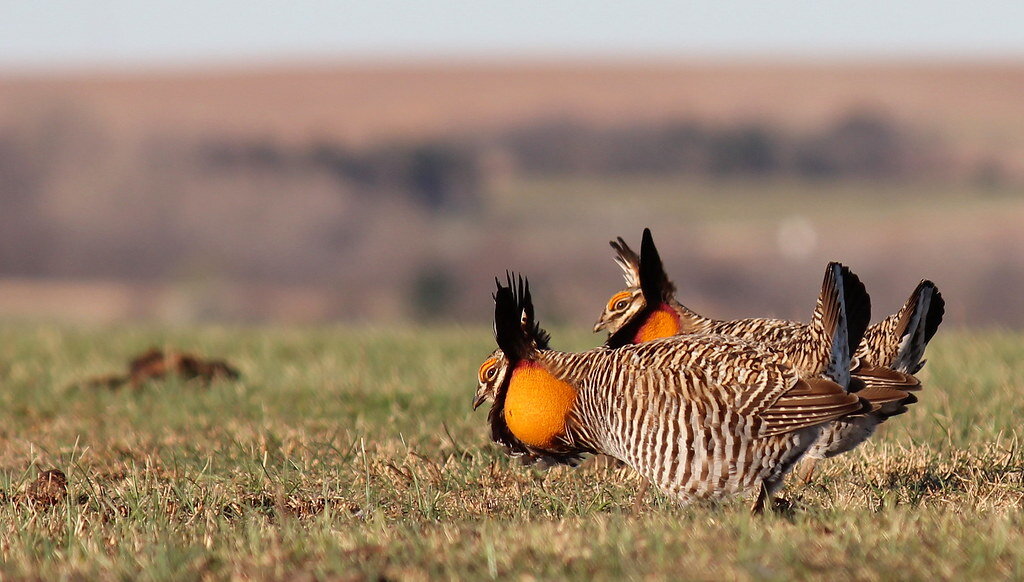
Male Greater Prairie-Chickens displaying. Photo by Greg Kramos/USFWS.
At the state level, depending on the election results, we may be looking towards active reintroduction of the gray wolf, which is currently almost extirpated in Colorado, though we have sparse/occasional occurrences in the northwest part of the state. In the next few months we may also see resolution of some issues regarding management of Greater Prairie Chickens on State Land Board properties in southeast Colorado, which are being pursued by the Audubon Colorado Council.
Locally, the important current issues will change less, though there are a couple on which major decisions are likely to be made soon. However, two of the three county commissioners will be replaced in this election. Of the incumbents, only Matt Jones will remain.
Gross Reservoir Expansion Project
This massive construction project (part of the Moffat Collection System Project) has been planned by Denver Water since 2009, or before. It would divert more water from the Upper Colorado (particularly the Fraser River, but also the Williams Fork) to support more sprawl in the Denver metro area and its surroundings.
If it proceeds, the Gross Reservoir Expansion would be the biggest construction project ever undertaken in Boulder County. It would raise the dam an additional 131 feet and increase the reservoir capacity by 40%. A major quarrying operation is planned and trucks going up and down Coal Creek Canyon would have huge impacts. While some of the construction materials could be transported by rail, this would be more expensive and is not planned.
Despite a questionable Environmental Impact Statement, Denver Water has received the necessary permits for the project from the US Army Corps of Engineers and the Federal Energy Regulatory Commission.
A 30-minute video on the expansion, by local producer Len Aitken, can be watched here.
Denver Water first claimed that Boulder County had no review authority on the project. The county asserted that Denver Water had to follow county regulations under what is known as 1041 authority. Denver Water sued, and when it lost in district court, it appealed. Most recently, it dropped the appeal, and it has now submitted an application for a 1041 permit. The only governmental body remaining to protect the public and the environment from impacts from this project is the Boulder County Board of commissioners, two of whom will be replaced in the November 3rd election (Elise Jones and Deb Gardner are term-limited).
South Boulder Creek Flood Mitigation—CU South
The dam that has been approved in concept by Boulder City Council would be built on 5 acres of city Open Space and is designed for a 100-year flood, but the Council has also directed staff to examine the “upstream option,” as requested by the Open Space Board of Trustees, so disputes over the conceptual design and impacts continue. The University of Colorado, which owns much of the land directly affected (CU South), has applied for annexation to the city, so that it can obtain water and utilities to build on the property, but it has not provided any details on what it plans to build there, much less than is normally required for annexation. Boulder City Council has not required a detailed site plan, nor has it instituted any public process with the surrounding neighborhoods (Martin Park, Majestic Heights, and Tantra). Since CU is a state entity, the City would have no regulatory authority on what is built, except for what is specified in the annexation agreement. Thus, the annexation agreement is critically important, and the current rushed consideration is particularly consequential.
Proposed Multi-use Trail from Eldorado Canyon State Park to Walker Ranch
Mountain bikers have long advocated for a multi-use trail from Eldorado Canyon to the county open space at Walker Ranch. Following any of the obvious routes beginning with existing dirt roads is complicated by the fact that they are private property, and the landowners have not been willing to accede to their use. There is no evidence that planners have pressed this possibility, by consideration of the use of eminent domain, for example. Instead, the last proposal was laid out in a feasibility study accessible here, which proposes a route that would cut dozens of switchbacks through the Western Mountain Parks Habitat Conservation Area (on Boulder Open Space and Mountain Parks (OSMP) land). No ecological study of the impacts of this proposed route has been done, which is all the more unfortunate, since the delay discussed below would have allowed ample time to do so.
The feasibility study was the joint product of the three land-owning agencies affected: Colorado Parks and Wildlife (CPW), OSMP, and Boulder County Parks and Open Space (BCPOS).
In July 2019, CPW decided to stop the planning process until it could address capacity concerns in a Visitor Use Master Plan (VUMP). CPW has now completed a draft of this plan, which it will unveil at the November meeting (November 19th and 20th) of the CPW Wildlife Commission. We can expect that once this has occurred, there will again be a big push to plan the trail, so this will become an urgent and contentious issue.